


BISAC NAT010000 Ecology
BISAC NAT045050 Ecosystems & Habitats / Coastal Regions & Shorelines
BISAC NAT025000 Ecosystems & Habitats / Oceans & Seas
BISAC NAT045030 Ecosystems & Habitats / Polar Regions
BISAC SCI081000 Earth Sciences / Hydrology
BISAC SCI092000 Global Warming & Climate Change
BISAC SCI020000 Life Sciences / Ecology
BISAC SCI039000 Life Sciences / Marine Biology
BISAC SOC053000 Regional Studies
BISAC TEC060000 Marine & Naval
The Shantar Islands is the group of islands satiated in the Sea of Okhotsk near the exit of Uda Bay, Tugur Bay and Ulban Bay. The islands separated from the mainland and started to exist only 6000 years ago. It happened under the influence of the sea transgression followed by flooding of some parts of the land surface and isolation of the most elevated mountain parts from the mainland. The climate of The Shantar Island is more severe than the climate in the North part of the Sea of Okhotsk due to its proximity to cold regions of Yakutia, complex system of wind and tidal currents, the duration of the ice period, loads of fog and frequent storm winds. The height of tides on the islands can reach 8 meters, and these tidal currents are considered as one of the fastest tides of the World Ocean. The ice near the islands appears in the beginning of November and doesn’t melt for 8-9 months, usually, till mid-July, but some years till mid-August. Such severe ice conditions cannot be observed anywhere else in the Sea of Okhotsk. The variety of forms of the Shantar Islands is a consequence of severe ice conditions, unusual tidal currents and irregularity of the seashore. The most important seashores forming factor is considered to be the activity of sea ice.
SEA ICE, SHANTAR ISLANDS, SEA COAST
The Shantar Islands is the group of islands satiated in the Sea of Okhotsk near the exit of Uda Bay, Tugur Bay and Ulban Bay. The islands separated from the mainland and started to exist only 6000 years ago. It happened under the influence of the sea transgression followed by flooding of some parts of the land surface and isolation of the most elevated mountain parts from the mainland.
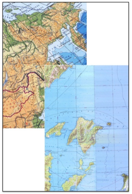
Fig. 1. Shantar Islands
The climate of The Shantar Island is more severe than the climate in the North part of the Sea of Okhotsk due to its proximity to cold regions of Yakutia, complex system of wind and tidal currents, the duration of the ice period, loads of fog and frequent storm winds. The height of tides on the islands can reach 8 meters, and these tidal currents are considered as one of the fastest tides of the World Ocean.
The ice near the islands appears in the beginning of November and doesn’t melt for 8-9 months, usually, till mid-July, but some years – till mid-August. Such severe ice conditions cannot be observed anywhere else in the Sea of Okhotsk.
The variety of forms of the Shantar Islands is a consequence of severe ice conditions, unusual tidal currents and irregularity of the seashore. The most important seashores forming factor is considered to be the activity of sea ice.
Activities of sea ice in the coastal shelf zone of the Shantar sea, as an agent of relief formation, on a scale comparable to the waves and tides.
Landforms parameters created under the influence of sea ice can reach few meters in depth, a few tens of meters in width, and a few kilometers in length. The volume of sediment in some parts of the underwater slope comparable to or greater than the volume of sediment transported by the action waves and currents.
Thus, the external border of the coastal zone is advantageously draw at a depth from which the wave stops processing the ice-ekzaratsionny forms and ice-ekzaratsionny microrelief becomes dominant.
The Shantar islands shores divided into four main geomorphological types:
Pebble-sand beaches with a predominance of small soil fractions distributed at the tops of the large bays with low-lying coasts, where silty-sandy beaches with an admixture of pebble and stone are formed under influence of tidal fluctuations and weakened wave mode conditions.
The most striking example of this type coasts are drying in Yakshina Bay on the island of Grand Shantar and in Swan Bay on the Feklistov island.
A sufficiently strong surface layer of frozen pebbles are formed on the pebble beach at the negative temperatures; the ice sheet appears and completely stops abrasion, even under the action of strong waves.
Apparently, ice movement occurs in this case not on the surface of the soil, but between its upper and lower layers.
Rocky shores develop in areas where high mountainous land is located near the sea. The degree of inclination of the surface is diverse - from vertical walls to a relatively flat horizontal areas. There are many cracks and depressions in which water is at low tide, or cleft, stretching inland. These formations are a type of ecological niches, which are very different by composition and stratification of organisms from the adjacent flat portions of the rocks.
In the case of rocky coasts composed of strong bedrock, ice can develop enormous pressure directly on the surface of rocks, tear pieces of rock, delete surface parts, damaged by weathering. Grinding action of moving ice, surely, leads to depletion and the sparseness of the population exposed surfaces and to the concentration of the littoral in cracks, cavities, various kinds of baths. In such circumstances, the nature of the rocks microrelief becomes a factor directly influencing the biomass and population density in the dominant groups of organisms.
Rocky-pebble shores are represented by two types. In some cases, portions of the rocks are located on a short distance from the shore, and they account for, as a rule, only the average horizon shore, and the other horizons are occupied by small fractions of the soil with a predominance of pebbles and boulders in the lower horizon and coarse-grained material (gravel, stones, boulders, pebbles) in the upper horizon. Another version of this type is rocky outcrops shore-stacks quite far removed from the coast. All horizons littoral zone of such stacks account for rocky ground, and the main beach is characterized in most cases the development of block-boulder intertidal zone. Ice effect on that geomorphological type is peculiar. The floating ices in Yakshina Bay in spring and summer make regular migrations under the influence of tidal currents. Huge ice floes dug long furrows deeper than a meter with heaps of sand at the ends of the furrows. Usually the furrows are located in the middle horizon of the coast in the central part of the bay, where is the main track movement of such "icebergs".
It should also indicate the important transporting role of the ice at "ice-floe-marine accumulation." The coastal slopes under the influence of weathering and denudation in the winter give the ice freezing of detrital material. In the spring ice floes are detached from the coast, picked up and taken out over the sea. And fraction of this type are leading in the composition of littoral soils because of repetition of these processes annually.
Regarding the impact of the ice on littoral organisms, most biologists only indicate the fact of its mechanical action and explain the emergence of these "dead zones" in the littoral zone. It should be noted that this mechanical action produce only because of ice floes, pushing on the bedrock of the shore, or whole ice field when approaching the surface ridging beaches. It should be considered that the solid ice cover is almost neutralizes the impact factor of the wave for a long period of time, as shown in the example of the Shantar Islands.
Thus, the ice activity is the most important factor in the formation of the Shantar islands's shores. At the same time the ice activity affects in different degrees, and this affect is always strong.
1. P.F. Brovko, “Geomorphology of the mainland coast and the unique coastal complexes of the Sea of Okhotsk”, Structural transformation in the ecosystems of the North-East Asia, Vladivostok: Dalnauka, 2015, pp. 20-24.
2. Ecological and economic rationale of establishing a national park “Shantar Islands”, Khabarovsk, 2012, vol. 1, p. 310.
3. L.I. Krasnyy, G.S. Ganeshin, “Geological and geomorphological essay Big Island Shantar, Feklistov and Prokofiev (Report of field work in the summer of 1948)”, Leningrad, VSEGEI, 1949, p. 446.
4. A.P. Nechayev, “Shantar Islands”, Questions of Geography of the Far East, Khabarovsk, 1955, vol. 2, pp. 18-35.
5. S.D. Shlotgauer, M.V. Kryukova, “Flora coastal protected areas of the Russian Far East: Botchinsky, Dzhugdzhur reserves, Shantar National Park”, Moscow: Nauka, 2005, p. 264.
6. V.A. Chetverova, A.S. Makarov, “Ice condition of the Laptev Sea and East-Siberian sea as a factor of formation the seas coastal zone”, Proceedings of the IV School-Conference of Young Scientists with international participation (26-28 August 2011), Petrozavodsk: Karelian Research Centre of Russian Academy of Sciences, 2011, pp. 49-52.