


BISAC NAT010000 Ecology
BISAC NAT045050 Ecosystems & Habitats / Coastal Regions & Shorelines
BISAC NAT025000 Ecosystems & Habitats / Oceans & Seas
BISAC NAT045030 Ecosystems & Habitats / Polar Regions
BISAC SCI081000 Earth Sciences / Hydrology
BISAC SCI092000 Global Warming & Climate Change
BISAC SCI020000 Life Sciences / Ecology
BISAC SCI039000 Life Sciences / Marine Biology
BISAC SOC053000 Regional Studies
BISAC TEC060000 Marine & Naval
The Kiziltashsky limans are the largest water bodies of land-to-sea interface zone of the Krasnodar region Black Sea coast separated from the Black Sea by Anapa bay-bar. Their territory is included in the Perspective list of the Ramsar Convention as a unique wetland of international importance. Currently, the main type of recreational use of the liman water area is active rest. A diversity of natural conditions, a small degree of economic transformation of the landscape in combination with good transport access makes it possible to combine the active recreation forms with health-improving rest at the Anapa resort. In the presented paper the different proposals for economic use of the Kiziltashsky limans are analysed in terms of influence to geoecosystem.
liman, Kuban river delta, economic use, recreation.
I. Introduction
The resort-town Anapa - one of the largest seaside Russian resorts is located near the Kiziltashsky limans. The Kiziltashsky limans is group of the big lagoons of the Russian Black Sea coast. The Kiziltashsky limans is part of the Tamansky liman system of the Kuban River delta and separated from the Black Sea by Anapa bay-bar [1]. The water area and coasts of the Kiziltashsky limans belong to the Anapa and Temryuk districts of the Krasnodar region. The limans are included in the Perspective list of the Ramsar Convention as a unique wetland of international importance [2]. In addition, the Kiziltashsky limans is the only area of the artificial reproduction of mullets in Russia.
Scientific estimate of the natural recreational potential of the Kiziltashsky limans is essential for spectrum broadening of the recreational activity, increase it scale, implication into recreational complex new areas. On the one hand the current natural differentiation of the recreation space creates special condition toward realization recreational goal of man, on the other hand the causes recreation organizers take into account information about various qualities of the natural constituents for the purpose of effective organization and sustained development of the recreational area [3]. However, attractive properties of the Kiziltashsky limans’ landscape are used scantily within the framework of the recreational activity in Krasnodar region because of absence of scientific and adapted information for users and recreational activity initiators.
II. Characteristics of the kiziltashsky limans’ geosystem
Kiziltashsky liman group consists of Lake Solyenoye, Bugazsky (Kiziltashsky) liman, Vityazevsky liman, Tsokur liman, Anapskiye Plavni (Fig. 1). Limans are formed in the gulf of the Black Sea after Anapa bay-bar generation [1].
The climate of the Kiziltashsky limans area is characterized by features of the Mediterranean type with wet winter and dry hot summer. Duration of the frostless season is 165-170 days. In summer the minimum air temperature is 24-26°C, an absolute maximum makes 39°C. The annual average rainfall amount is from 254 to 717 mm, within a year they are distributed rather evenly. Now functioning of the Kiziltashsky limans’ geoecosystem largely is regulated by the hydrological regime of the Black Sea adjacent water area [4]. This area differs from other Russia Black Sea coast by bigger amplitude of the sea level fluctuations. Annual average level can deviate from annual average mark. The maximum excess 16 cm and the maximum decrease 24 cm are noted. The intra-annual level depends on seasonal climatic factors. On their background the acyclic fluctuations of the level variability are shown [5].
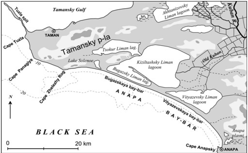
Fig. 1. Location of the Kiziltashsky liman group [6].
Formation of the Kiziltashsky limans’ group and the Anapa bay-bar started 8-5th years ago when the last glacier period ended. The level of the Black Sea at that time was by 80-90 m below its present level [7]. After the Holocene transgression (7-5th yr. BP) the alluvium of the Kuban River was not transported to the basin of the Black Sea, instead it accumulated in the basins of the bays (future lagoons) The formation of the Anapa Bay-bar occurred from the coast abrasion material. The products of shore destruction were entrained into the alongshore flow of sediments forming spits with the basement at the southern tips of capes gradually closing the entrances to Bugazsky (Kiziltashsky) and Vityazevsky bays [7]. After the northern and southern parts merged, a system of the Kiziltashsky limans was formed.
The Kiziltashsky group was united into a single water basin (“Kuban liman”), through which the Kuban River debouched into the Black Sea. As the alluvial sediments accumulated in the estuary of the river, the parts of the lagoon separated and formed the smaller lagoon [1].
Vityazevsky liman is located at north of Anapa. It is separated from the Kiziltashsky group by accumulative sediments of the Kuban River and remains of the Blagoveshchensky butte [8]. The water supply occurs due to the atmospheric precipitation and surface discharge as well as by the waters of the Black Sea, which are filtered by the bay-bar and over washed during the storms. Additional artificial water supply to the lagoon occurs by means of the irrigation system of the Old Kuban River in the region of the Suvorov-Cherkessky town. Now Vityazevsky liman has no direct water exchange with other Kiziltashsky limans and sometimes it is considered as a separate nature reservoir.
The Kiziltashsky limans located to the north of the Blagoveshchensky butte are uniform hydrological object. The Kiziltashsky limans group is divided into three main parts by configuration of the coast and accumulative forms: Kiziltashsky liman (its area is 15700 ha), Bugasky liman (4050 ha), and Tsokur liman (4670 ha). All parts are shallow basins of the lagoon type. The depths vary from 0.3 to 2.5 m. A direct permanent water exchange exists only between Kiziltashsky liman and Bugazsky liman (Fig. 1). The water exchange between Kiziltashsky liman and Tsokur liman is small due to the low water level.
Up to the end of the 19th century the water from the Kuban River was flowing to the Kiziltashsky liman. The water excess was flowing to the sea through the Bugazsky Channel, which is 150-650 m wide. In the 1940s, the transport of the Kuban water to Kiziltashsky liman terminated. In January 1955, a channel of the Kiziltashsky mullet fishing farm was made between the sea and the Bugazsky liman, which was regulated by a water lock [9]. The artificial Bugazsky Channel (sea water supply) and the Main Channel (fresh water supply from the Kuban River) controls the water exchange in the lagoon.
Simultaneously, the operation of these channels provides seasonal migrations of the mullet fish. As a result of shallowness and lack of free water exchange with the Black Sea the hydrological regime of the Kiziltashsky group is distinguished for high dynamics. In the summer time, the water level in the lagoon may decrease to 0.1-0.2 m below the sea level, while in the winter time it can exceed the sea level by the same value [7]. As a result of the non-uniform water supply with the fresh and sea waters, salinity fluctuates strongly in time and over their territories. Salinity in the Bugazsky liman fluctuates within 39.5-50.0‰, in the Kiziltashsky liman it ranges within 29.0-58.0‰. The maximum salinity (82‰) was recorded in the western part of the Tsokur liman (in August), while the minimum salinity (18‰) was in the mouth of the main channel and the Gostagaika River [2].
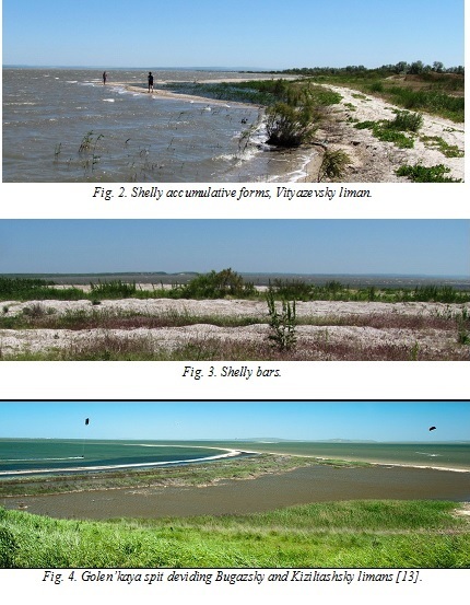
Coast of Kiziltashsky limans’ group is presented by sites of the original abrasion coast and accumulative forms. Original coast as a rule is high with the expressed cliff. Accumulative sites are presented, first of all, by fragments of the Anapa bay-bar separating liman from the sea. Vityazevskaya bay-bar has width of 0.5-1.0 km, Bugazskaya bay-bar has width of 0.08-0.3 km. Within the Anapa bay-bar there are pronounced eolian forms (dunes) here and there coming closely to the liman coasts. One or more beach bars up to 0.5 m in height are observed along the water edge. The bars are composed of mollusk shells dwelling in the lagoon. Comparatively small spits are located by capes of the original coast or curves of the Anapa bay-bar body. Golen’kaya spit separating limans Bugazsky and Kiziltashsky is the largest one. Despite the high changeability of volume and configuration, the spit has already existed at least for several centuries (Fig. 2-4).
Both the original coast sections and accumulative ones are characterized by a considerable decrease of the water level and exposure of vast bottom areas along the coast in summer and autumn. The fluctuation range of the sea level and the foreshore area in Vityazevsky liman are considerably higher than those in Kiziltashsky and Bugazsky limans.
The liman costs above the foreshore are covered with near-water vegetation (Fig. 5). The vegetation types are as follows: overflow lands, meadows, steppe meadows, salt marshes, flood-plain forests, and psammophilous.
Overflow lands occur at the site of limans and can be considered as a certain stage of their extinction. This vegetation type is represented by Arundinoideae or Typhoideae communities spreading along the liman coasts and covering significant areas.
Steppe meadows occupy raised sections of the liman main coasts. Meadow plants prevail in the grass but they are necessarily accompanied by steppe species. On the west liman shores, the coastal flora is contiguous with wormwood-turf-gramineous plant steppes. On the east and north coasts, mixed herbs-fescue-feather grass steppes adjoin the coastal vegetation.
In liman apexes, where the salt regime and hydrological conditions change quickly, the coastal area is partly occupied by salt marshes. The plants are adapted to the higher salt content in the environment. Well-marked phytocenoses’ boundaries are peculiar to the vegetation [2].
The psammophilous plant complex is represented on the liman shores within the limits of sandy Anapa bay-bar. On the segments with weakly fixed sands the vegetation mainly consists of plants adapted to the life under conditions of movable substrate. The most typical species is Elymus arenarius, a gramineous plant with long rhizomes. On the settled sandy substrate the of the plant communities composition changes and phytocenoses are of more stable character [2]. On the sections with sands which are the least effected by wind and water, habitual meadow species occur.
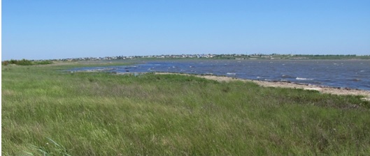
Fig. 5. Liman coast.
There are no forests on the liman coasts but individual instances or clumps of trees and bushes composed of local and introduced species (Elaeagnus angustifolia L., Populus, Gleditschia, Robínia pseudoacácia, Cotinus coggýgria, Támarix, Ligústrum, Ácer, and Sálix) may occur. The trees are of 3–5 m in height. There are gardens and vineyards limited by forest belts near the settlements [10].
Islands and peninsulas in the limans are only about 1% of the total area.
In the open water area of the limans, Ruppia spiralis and Zostera marina are widely spread and form underwater thicket with projective coverage up to 80–90%. The state of the plant communities in the limans was significantly influenced by sharp changes of hydrological and hydrochemical characteristics resulted from changes of the Kuban river discharge and subsequent anthropogenic regulation of the liman ecosystem.
Forty five species of fish inhabit the Kiziltashsky limans. As far as invertebrates are concerned, there are numerous Black sea mussels (Mytilus galloprovincialis), mytilasters (Mytilaster lineatus), Mediterranean green crabs (Carcinus mediterraneus), warty crabs (Eriphia verrucosa), and mysids (Mysidacea) in the salt waters of the fishing area. The Kiziltashsky limans are of great importance for reproduction of colonial near-water birds, including rare ones; 21 bird species have their nests there. The limans are the most important place to have a rest for natatorial and near-water birds during the migration period. Approximately 12–18 species of natatorial and near-water birds stay for wintering there (Fig. 6) [9].
III. Current and perspective practical use of the Kiziltashsky limans
Prospects for economical use of the Kiziltashsky limans essentially depend on a number of natural and anthropogenic factors. In fact, the whole geoecosystem of the limans has been natural and technogenic already for more than 60 years.
The Kiziltashsky limans, which were basins with fresh lotic waters, having lost the replenishment with the Kuban river waters and the open water exchange with the sea in the early years of the 20th century, became stagnant basins with higher salinity. Almost complete drying out of the limans was observed in the 1940s – 1950s. If the artificial replenishment of the limans with fresh and sea waters is stopped, salinization and drying out of the limans will occur again in a few years. At present the limans’ ecosystem actually exists only due to the human intervention. Thus, the anthropogenic impact under consideration can be estimated in total as favorable for supporting biodiversity and productivity of the limans’ ecosystems.
.jpg)
Fig. 6. The cranes on the liman coast.
Sixty five fish species lived in the Kiziltashsky lagoons before their salinification. Now, their number decreased to 45 species [11]. In 1955, a separate mullet fishing farm with a total square of 24.4th. ha was formed in the Kiziltashsky lagoon group (Bugazsky liman, Kiziltashsky liman, and Tsokur liman). In autumn, large sexually mature grey mullet and young fish were caught here. Since 1978 the Kiziltashsky lagoon group started to be used for fattening reproductive basins to replenish the Caucasus grey mullet stock. Fattening in the lagoons is a biological necessity for Caucasus mullet. Intense growth of mullets, increase in fatness, and fat accumulation occurs only when they are fed by fouling and detritus, which are abundant in the lagoon group. The Kiziltashsky fattening reproduction farm is the only farm in the south of Russia for fattening and reproduction of the Azov-Black Sea mullet. Young fish and the fish of greater age, which appeared in the lagoon after passing the artificial channel with the sea, fatten in the lagoon group. In summer, the mullet reproducers travel to the sea for spawning. The grown specimens of the Azov-Black Sea mullets return to the sea for wintering. On the basis of the mullet Mugil soiuy acclimatized in 1987-1989 from the Far East to the Black Sea the self-replicating population was formed. In spring a total of 300-400 th. specimens of the Azov-Black Sea mullet and Mugil soiuy mullet reproducers enter the Kiziltashsky lagoon group. In winter, the young Mugil soiuy mullet fish and fish of greater age migrate to the channel that starts in the Kuban River and debouches into iziltashsky liman, while part of the Mugil soiuy remains in Kiziltashsky liman.
At present, no commercial fishery activity is performed in the Kiziltashsky lagoon group. Spawning-fattening farm is involved only in the reproduction and protection of mullet fish.
Vineyards and gardens are located on the western and northern shores of the lagoons. The accumulative isthmus between Kiziltashsky liman and Vityazevsky liman is used for planting irrigated plants. Eight fattening and milk farms are located around the lagoons. Cattle breeding pastures are located around the lagoons and haying is organized here [12].
In recent years projects for filling of the liman water area are put forward for the creation of man-made objects or harbors for ships. Due to technical difficulties (small depth, alongshore sediment flux) and eventual environmental problems (protective construction can lead to erosion of the bay-bar sandy coasts) the projects have not received development.
Recently the new General plan of the Anapa resort development has been developed and approved. According to the General plan, one of the elements of the planned development of the Vityazevo town is formation of several artificial islands in the basin of Vityazevsky liman. It is planned to locate recreation zones in the new territories and related constructions (Fig. 7).
As it is mentioned earlier, shallow water is one of the peculiarities of the Kiziltashsky lagoon group. The depth over the major part of the basin does not exceed 1.5-2 m. The water exchange between the lagoons is low. The concentration of organic matter in the lagoon group is high, and water is strongly heated in the summer time. These causes intense water blooming and accumulation of large amounts of died-off algae in the summit parts of the lagoon group and at their shallow beaches. Toxic substances are formed during the vital activity of some micro-algae and their degradation, which are hazardous for the aquatic fauna and humans. Disgusting stink of decaying algae in summer decreases the recreating potential of the Vityazevo town. Creation of artificial islands and separation of the stagnant part of Vityazevsky liman will clearly lead to the intensification of the negative processes. The newly formed territories and the objects located on these lands will lose their investment attraction.
.jpg)
A lack of treatment facilities at recreational objects, especially seasonal ones, should be noticed among negative anthropogenic factors. The negative impact of the municipal solid waste entering the limans from the surrounding coasts or from the Black sea is evident. The shores of spits and islands are littered with plastic cans, bottles, paper, etc. Burning the near-water vegetation causes a considerable damage to the limans’ fauna.
Thus, successful implementation of the scheme offered by the General plan will demand performance of continuous actions for water cleaning of Vityazevsky liman.
Location of an industrial and communal zone, which is necessary to provide functioning of objects of the designed gambling zone, at the entrance to the village of Blagoveschenskaya from the direction of the settlement of Suvorov-Cherkessky can cause negative subsequences. The general layout also provides for construction of a new road running directly along Vityazevsky liman coast. The road exploitation will necessarily cause a considerable increase of pollution entering the basin. As the above mentioned area is included into the water protection zone of water objects, this solution is not correct and brings about an increase of anthropogenic load on the ecosystem of Kiziltashsky and Vityazevsky limans. In addition to that, location of cultural and entertaining objects will inevitably break the conditions of habitat and migration for natatorial birds.
Along with estimating the anthropogenic impact upon the Kiziltashsky limans’ geoecosystem, natural threats should also be mentioned. Our research showed [8] that the sea shore recession has taken place at Anapa bay-bar for the last decades. The reduction in width of the accumulative body’s above-water part is observed for a number of the Bugaz bay-bar segments. In case of continuing shore recession, the above-water part of Bugaz bay-bar can decay. Nevertheless, we consider Bugazsky liman joining with the sea to be favorable for the Kiziltashsky group of limans. Given the permanent water exchange with the sea, the water level and salinity in the liman will be stabilized. Seasonal migrations of fish will take place in a natural way. A similar ecosystem change can also happen with Vityazevsky liman, but taking into account that Vityazevo bay-bar is significantly wider, a resumption of the permanent water exchange with the sea could be hardly expected there in the foreseeable future.
At present, the prospects for exploring the area of Anapa bay-bar and the Kiziltashsky limans suppose the prevailing development of the recreation sector. At the same time, a proper recreational infrastructure will be developed. With the observance of environmental legislation and carrying out of measures to increase stability of the Kiziltashsky limans, the above mentioned exploration will not cause considerable damage to the unique marine coastal landscape. The plans of constructing cargo or naval ports in the water areas of the Kiziltashsky limans do not seem to be very realistic especially with the opportunity of building such objects on the Taman peninsula. The agricultural development supposed within the limits of the Kiziltashsky limans’ drainage area can result in increasing pollution of the surface waters. Taking in account the specialization of the region (high-technology wine-growing) this impact will not be significant while keeping up the technologies.
IV. Conclusion
A diversity of natural conditions, a small degree of economic transformation of the landscape in combination with good transport access makes it possible to combine the active recreation forms at the Kiziltashsky limans with health-improving rest at the Anapa resort. The optimum variant is to increase the recreational potential of the Kiziltash limans and the development of the area as a resort that will be promote to balanced economic development of the region. Nevertheless now the recreational potential of the Kiziltashsky limans is used insufficiently. At the present stage of the resort development it is necessary to increase the recreational attraction, esthetic expressiveness and ecological stability of used landscapes. The advanced types of the liman water area recreational use are active rest: sportfishing, kiting, windsurfing and others. A variety of flora and fauna gives the chance for development of a network of ecological tracks and to develop cultural-informative of tourism sector. Creation of the mud-therapy resort is possible at Lake Solenoe. For expansion of the recreational opportunities it is necessary to reach a decision of a number of the problems connected both with existence of natural risks and with irrational economic use.
The most important inter-branch contradiction, both now and in the near future, is the conflict between recreational use of the Kiziltashsky limans and natural landscape protection. For solving this problem it is necessary to determine boundaries of the first protection zone of the resort including the entire dune zone and the liman coasts which are an integral part of the coastal recreational resource. Also it is important to create a specially protected natural territory based on the Ramsar wetlands and the Anapa resort area. Within the protected natural territory it is necessary to establish a differential protection regime taking in account natural, historical, cultural, economical and other peculiarities. The functional zones, selected on the base of natural and social-economic factors, should contribute to the efficient economical use with the best advantage for the region economy and also provide the proper protection for the unique natural complex of the Kiziltashsky limans.
V. Acknowledgments
The researchers are realized with support of the Russian Science Foundation (project no. 14-50-00095).
1. R.D. Kosyan, S.B. Kuklev, V.V. Krylenko, “Fragile equilibrium of the Anapa Bay Bar,” Priroda, 2012, № 2, p. 19-28 (in Russian)
2. Wetlands of Russia official website, URL: wetlands.oopt.info (in Russian)
3. A.V. Bredikhin, “Recreational property of the relief, MSU bulletin,” 2004, V. 5, №6, p.68-73 (in Russian).
4. Climate of the Russian Seas and the Key Regions of the World Ocean: Digital Atlas (Join Informational System on the World Ocean (ESIMO), Obninsk (2007) (in Russian). http://www.esimo.ru/atlas/Black/2_waterlevel_station_98062_3.html
5. Catalogue of observations above the Black sea and Sea of Azov level (1990) SO GOIN. - Sevastopol, 115 p. (in Russian)
6. R.D. Kosyan (ed) “Scientific support for the balanced business planning on the unique coastal landscapes and proposals for its use by the example of the Azov-Black sea coasts”, Research Report, ed. Gelendzhik, 2013, 1860 p. (in Russian)
7. Ya.A. Izmailov, Evolutionary Geography of the Black Sea and Sea of Azov Coasts Book 1: Anapa Bau-bar, Sochi, 2005, 174 p. (in Russian)
8. R. Kosyan, B. Divinskiy, V. Krylenko, A. Kosyan, M. Krylenko, S. Kuklev, “The forecast of Anapa bay-bar coast evolution and sandy body thickness change”, Proc. of the Int. Conference on Coastal Engineering Practice. ASCE. USA, 2011 P. 42-55.
9. V.N. Mikhaylov, D.V. Magritsky, A.A. Ivanov (eds.), “Hydrology of the delta and offshore zone of the Kuban river”, Moscow, GEOS, 2010, 728 p. (in Russian)
10. A.M. Aleynikova, V.V. Krylenko, M.V. Krylenko, “Role of vegetation in stabilization of Anapa bay-bar landscapes”, the RUDN Bulletin, the Ecology series, 2015, № 3. P. 27-32.
11. A.N. Svetovidov, “Fishes of the Black Sea”, Leningrad, 1964, 552 p. (in Russian)
12. A.L. Mishchenko (ed), “Wetlands of Russia. Wetlands of the Northern Caucasus”, Moscow, Wetlands International, V. 6., 2006, 316 p. (in Russian)
13. R.D. Kosyan, V.V. Krylenko, “Modern status of marine accumulative shores of Krasnodar region and their use”, Nauchnyi Mir, Moscow, 2014 (in Russian)